Projects

TomaGold Corp. is a Canadian junior mining company focused on acquiring, exploring, and developing high-potential projects, primarily targeting gold, copper, zinc, precious and base metals, lithium, and rare earth elements in Ontario and Quebec. The company holds numerous claims around the Chibougamau Mining Camp and in the James Bay area. The objective, consolidation of the Chibougamau Mining Camp. In the James Bay area, the focus is on Lithium and Rare Earth Elements (REE).

Chibougamau Mining Camp (Quebec)

Berrigan Mine Project

High-Grade Gold-Zinc Deposit with Significant Expansion Potential

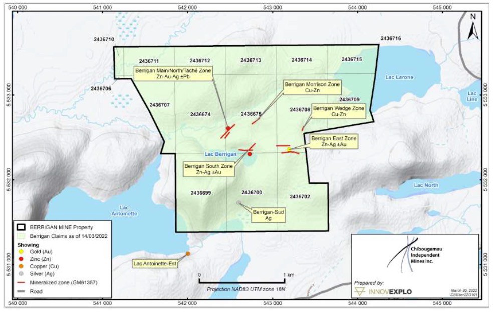
The Berrigan Mine Project is an advanced-stage gold-zinc exploration project located just 4 km north-northwest of Chibougamau, Québec, in the prolific Chibougamau Mining Camp. Recent exploration has significantly expanded the geological understanding of the project through the discovery of the Berrigan Deep Zone, a new polymetallic mineralized structure located beneath the historically recognized mineralization. Extensive drilling, supported by modern geophysical surveys and three-dimensional geological modelling, has demonstrated the continuity of this new zone while identifying multiple high-priority targets for future exploration. With broad mineralized intercepts, numerous high-grade intervals and strong geophysical support, the Berrigan Mine Project continues to demonstrate significant discovery and expansion potential.

Click to see the entire CIM report on this property.

Project Highlights

  • Option to acquire a 100% interest in the Berrigan Mine Project
  • 16 mineral claims covering 483 hectares
  • Located in Québec’s world-class Chibougamau Mining Camp
  • Historical (non-NI 43-101 compliant) resource estimate of 1.39 million tonnes grading 3.17% Zn and 1.77 g/t Au*
  • Discovery of the new Berrigan Deep Zone in January 2026, revealing broad polymetallic mineralization with multiple high-grade gold-zinc intercepts
  • Mineralization remains open laterally and at depth, providing significant potential for further expansion


Project Overview

The Berrigan Mine Project hosts a polymetallic hydrothermal system containing gold, zinc, silver and copper mineralization associated with altered ultramafic rocks. Historical exploration established the presence of a substantial mineralized system on the property. TomaGold’s recent exploration programs have significantly expanded that system through deep drilling, modern geophysics and integrated three-dimensional geological modelling. These programs resulted in the discovery of the Berrigan Deep Zone, demonstrating that mineralization extends well below the historically recognized zone and remains open for expansion.


Berrigan Deep Discovery

The discovery of the Berrigan Deep Zone marked a major advancement in the geological understanding of the Berrigan Mine Project. Discovery hole TOM-25-015 intersected 98.50 metres grading 5.08% ZnEq (1.19 g/t AuEq) at a depth of more than 450 metres, establishing a new polymetallic mineralized zone beneath the historically recognized Berrigan Main Zone. Phase 2 extension drilling subsequently demonstrated the scale and continuity of the new system. TOM-25-011EXT intersected a broad 204.25-metre mineralized envelope grading 2.05% ZnEq (0.48 g/t AuEq), confirming the vertical continuity and extent of the Berrigan Deep mineralized system. TOM-25-009EXT further expanded the Berrigan Deep Zone, extending its demonstrated lateral continuity to more than 250 metres. The hole was extended from 276 metres to a final depth of 621 metres and successfully intersected the upper portion of the modeled conductive plate. The result confirms strong lateral and vertical continuity of the mineralized system while providing further validation of TomaGold’s three-dimensional geological and geophysical model. The Berrigan Deep Zone remains open for further expansion.

Drill Highlights

Hole

Significance

Best Interval

Highlights

TOM-25-009EXT

Berrigan Deep – lateral extension & model validation

29.90 m @ 2.24% ZnEq (0.52 g/t AuEq)

Extended the demonstrated lateral continuity of Berrigan Deep to more than 250 m. The hole was extended to a final depth of 621 m and successfully intersected the upper portion of the modeled conductive plate, providing further validation of TomaGold’s 3D geological and geophysical model.

TOM-25-011EXT

Berrigan Deep – vertical extension

204.25 m @ 2.05% ZnEq (0.48 g/t AuEq)

Broad mineralized envelope demonstrating the vertical continuity and scale of the Berrigan Deep system. Includes 20.90 m @ 7.29% ZnEq (1.70 g/t AuEq) and 6.90 m @ 15.90% ZnEq (3.72 g/t AuEq).

TOM-25-015

Berrigan Deep – discovery hole

98.50 m @ 5.08% ZnEq (1.19 g/t AuEq)

Discovery hole that established the Berrigan Deep Zone at more than 450 m depth. Includes 49.35 m @ 6.41% ZnEq (1.50 g/t AuEq), 14.60 m @ 9.06% ZnEq (2.12 g/t AuEq), 6.20 m @ 13.15% ZnEq (3.07 g/t AuEq) and 4.90 m @ 23.20% ZnEq (5.44 g/t AuEq).

TOM-25-009

Berrigan Main Zone – high-grade mineralization

48.05 m @ 6.68% ZnEq (1.57 g/t AuEq)

Broad, high-grade polymetallic mineralization, including 2.90 m @ 39.03% ZnEq (9.15 g/t AuEq) and 5.40 m @ 21.86% ZnEq (5.12 g/t AuEq). A second interval returned 15.20 m @ 5.44% ZnEq (1.27 g/t AuEq), including 2.55 m @ 25.15% ZnEq (5.85 g/t AuEq).

TOM-25-010

Berrigan Main Zone – continuity

48.30 m @ 2.67% ZnEq (0.62 g/t AuEq)

Confirmed broad polymetallic mineralization and continuity of the known mineralized system, including 6.25 m @ 12.87% ZnEq (3.00 g/t AuEq).

TOM-25-014

High-grade sulphide mineralization

2.10 m @ 28.69% ZnEq (6.73 g/t AuEq)

Demonstrated the presence of additional high-grade sulphide mineralization, with multiple high-grade intervals intersected in the hole.


Interactive 3D Geological Model

Investors can explore the Berrigan Mine project through MiningHub’s interactive 3D viewer, which includes drill holes, geological interpretation, mineralized zones and other exploration datasets.

View the Interactive 3D Model on MiningHub


* The property has been the subject of more than one historical estimate. Met-Chem Canada Inc. prepared the most recent of these in April 2001 in a report titled: “Pre-feasibility study: Etude Conceptuelle, Projects Berrigan and Tortigny” by Chuinard et al. In the report, a resource estimate completed using polygonal estimation techniques stated 1.39 Mt grading 3.17% Zn and 1.77 g/t Au on the main Berrigan Mine zone. No resource classifications were given for the resource (GM61359). The mineral resource estimate presented above is historical in nature and was not prepared in accordance with National Instrument 43-101 standards. Accordingly, the reader is cautioned not to rely on this estimate, as the Company is not treating the estimate as a current mineral resource. The qualified person has not done sufficient work to make the resource current. Substantial data compilation, verification, and, potentially, additional drilling and resampling would be required by a qualified person before the historical estimate could be classified as a current mineral resource. There can be no assurance that any portion of the historical mineral resource will ultimately be confirmed or demonstrated to be economically viable.

Summary

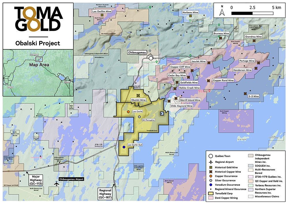
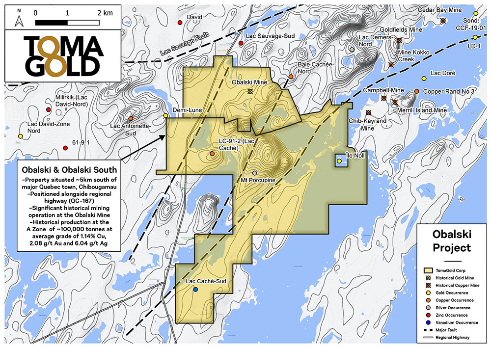
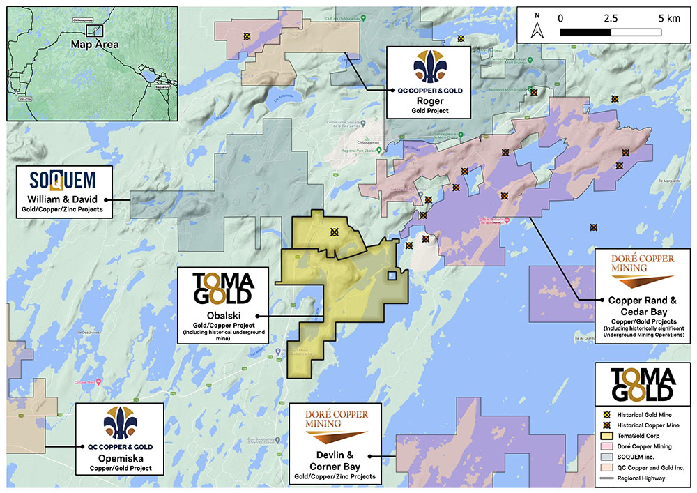
TomaGold owns 100% of the Obalski property, a former gold-silver-copper producer. The property consists of 75 claims covering an area of 2,740 hectares or 27 km2, located approximately 2 km south of Chibougamau, Quebec, in the heart of the Chibougamau mining camp.

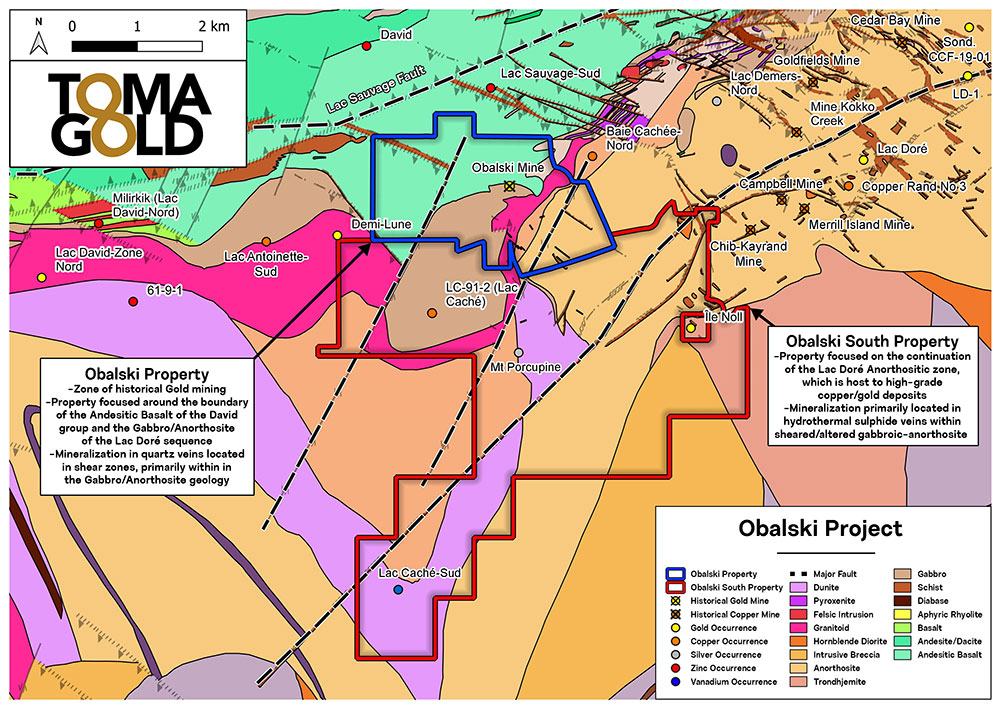
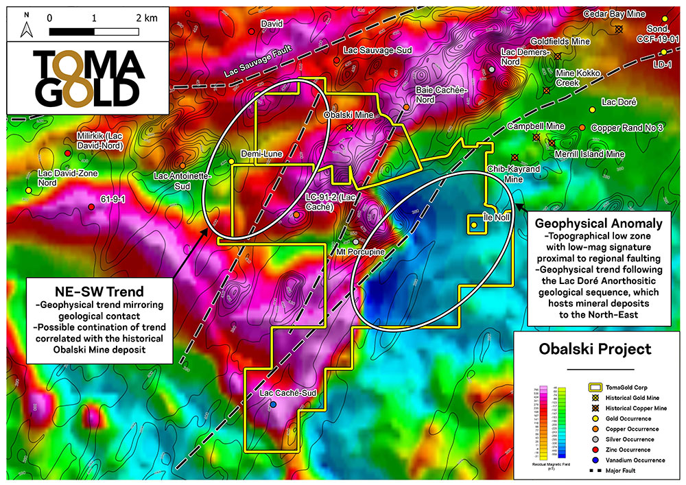
The Obalski property includes an 85-metre shaft and two ramps. Obalski hosts nine separate Au-Ag-Cu mineralized zones – the A/A-Po, B, C, D, G, South, Beaulieu, Peninsula and Wilson Zones in the Doré Lake Intrusive Complex.

Since the 1930s, 542 holes have been drilled on the property, for a total of more than 78,000 metres of drilling. Most of the historical drilling done prior to TomaGold’s acquisition date were less than 100 metres deep.

Geology

Gold-copper mineralization of economic interest at Obalski occurs as sulphide-rich (up to 60%) quartz-carbonate veins within highly chloritized, carbonated and pyritized shear zones. Mineralization varies from massive to disseminated. The quartz veining is injected within fractures/shears.

Historical production

Exploration began on the Obalski property in 1929. A shaft was sunk in 1936 to explore and develop the A zone and was used from 1964 to 1972 to mine 100,273 tonnes grading 2.08 g/t Au, 6.04 g/t Ag and 1.14% Cu from the A zone. A ramp was developed to access the D zone and mine 9,000 tonnes grading 8.50 g/t Au in 1983-1984, with the ore processed off-site at a local mill.

TomaGold Drilling Results

Summary of the best drilling results on Obalski since its acquisition by TomaGold in 2016:
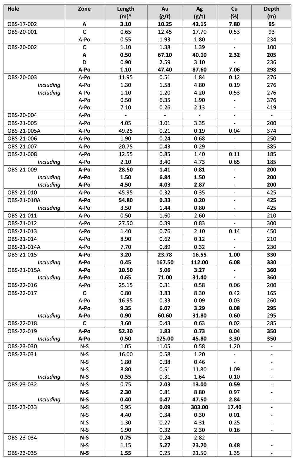
*  True width is estimated at 65-70% of core length, with the exception of holes OBS-23-30 to 35, which were not estimated.
Summary

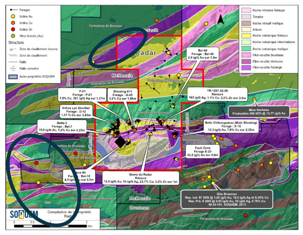
The Radar property, located 3 km north of the city of Chibougamau, was staked following the discovery of a copper-gold structure on the adjacent Brosman property, held by SOQUEM.

The property contains the northern extension of the epigenic fracture host system of the copper-gold structure of the Brosman deposit as well as the extension of a major E-W fault, host of the former Norbeau mine. The property contains an abundance of polymetallic showings and an exploration ramp is found in the area of the Belle-3 showing.

From a regional perspective, mineralization and hydrothermal alteration are spatially and genetically related to the shear zones. The Au-Cu-Ag-Zn polymetallic veins of the area are lodged in epigenetic fractures and in early (pre-D2) discordant (N-W, N, NE) faults with respect to the dominant E-W tectonic grain. Many of these mineralizations are hosted in competent mafic intrusions such as the Cummings Intrusive Suite (e.g., Berrigan Lake deposit) or the Smith Sill (Brosman deposit). In many cases, these intersections correspond to the location of mines and deposits and are prime targets for the discovery of this type of mineralization.

The abundance of polymetallic showings (Au, Ag, and Cu) and the numerous shear and fracture zones give this property excellent discovery potential for polymetallic vein deposits, orogenic gold and Cu-Ni-PGE deposits ± Co. The property also has the potential for an SMV-type deposit in the second volcanic cycle felsic rocks of the region.

The property is in the exploration drilling stage. Some areas require a better structural understanding to consider a new drilling campaign.

Click to see the entire SOQUEM report on this property.

Location and Infrastructure

The property is located in Canada, in the province of Quebec, and more precisely 3 km north of Chibougamau, a city offering a qualified workforce in the mining sector (Figure 1). A railway and a well-developed electricity network pass close to the town and a few kilometres from the property. It is also located approximately 9 km north of the Copper Rand mine site, which has a copper-gold ore processing mill and tailings pond. The property, which is intersected by numerous forest paths, is accessible all year round. A regional airport located between Chapais and Chibougamau is also part of the regional infrastructure.

The nearest municipalities are the cities of Chibougamau and Chapais as well as the two Cree communities of Mistissini and Oujé-Bougoumou.

Summary

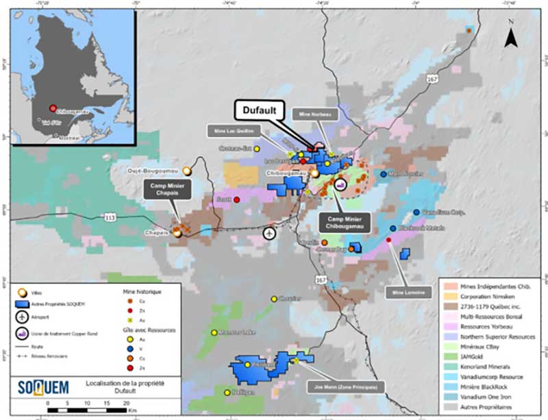
The Dufault Property, located 5 km north of the town of Chibougamau, has excellent potential for Au-Cu porphyry mineralization. The MOP-II deposit on the adjacent Roger Property owned by SOQUEM and Québec Copper & Gold Inc. is hosted along the same horizon in similar units. The mineral resources defined for the deposit include 10.9 Mt at 0.95 g/t AuEq in the indicated category and 6.57 Mt at 0.96 g/t AuEq in the inferred category (NI 43-101 Technical Report, 2018).
Gold-bearing intervals in holes 1311-02-03 (0.12 g/t Au over 124 m) and 1311-09-08 (0.24 g/t Au over 193.4 m) suggest the presence of a large mineralized zone whose boundaries have yet to be defined. Considering the lack of outcrops and the fact that only eight (8) holes have been drilled along a prospective horizon of more than 3.5 km, these results represent a high success rate and suggest excellent discovery potential. SOQUEM’s recent modelling work indicates that historical drilling, which targeted the gold-bearing porphyritic tonalite horizon, was stopped too early. To test this hypothesis, three historical drill holes should be extended and exploration continued along the favourable horizon. The project is at the exploration drilling stage.

Click to see the entire SOQUEM report on this property.

Location and Infrastructure

Located 5 km north of Chibougamau (Figure 1), the property is accessible by a gravel road leading to an landfill site and the former Gwillim mine. A sandpit is currently operating in the southwestern part of the property, and there is a hard-packed dirt track in the northwestern part for off-road vehicles. No outcrops are present on the property. The Quaternary cover is 10 to 60 metres thick, and lakes and rivers account for less than 2% of the area. The available infrastructure consists of an electrical network (the Obalski substation, 9 km south-southwest of the property, and the power line to the former Troilus mine that crosses the property from NE to SW), a rail line joining the national rail network, and a regional airport between Chapais and Chibougamau.

The Chibougamau mining camp, with a mining history dating back to the early 1950s, has a skilled workforce for both underground and surface mining. The camp includes the former Copper Rand mine, whose infrastructure is still in place, including the mill and tailings pond. The nearest municipalities are the city of Chibougamau and the town of Chapais as well as the two Cree communities, Mistissini and Oujé-Bougoumou.

Summary

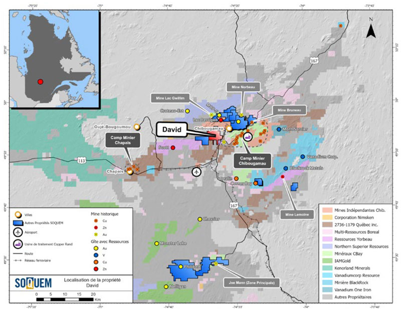
The David Property is less than 2 km from the town of Chibougamau, in the northeastern Abitibi Greenstone Belt. The property is characterized by a large number of gold and zinc occurrences:

• Pierrot-East Lake, hole 1165-09-19: 2.0 g/t Au over 21 m
• David Zn-Au: 6.2 % Zn over 1 m (channel) and 4,0 g/t Au over 1 m (channel)
• David Au: 4.73 g/t Au over 1 m (channel)

The advantageous position of the project within a deformation corridor and over a transition zone between two volcanic cycles make it a high-quality prospect for discovering economic VMS deposits.

Click to see the entire SOQUEM report on this property.

Location and Infrastructure

The property is in the Province of Quebec, Canada, 1.5 km southwest of the town of Chibougamau (Figure 1). Access is from Chibougamau via Route 167 which runs along the east side of the property. Many gravel roads and all-terrain vehicle trails branch off the road, providing access throughout the project. The property has little topographic relief. Outcropping areas are abundant except at the northern end of the property where the Quaternary cover of fluvio-glacial sediments is more than 20 metres thick. Lakes, rivers and swamps account for less than 5% of the area. An operating gravel pit is present in the northeastern part of the property and a borrow pit lies to the south of the operation. The infrastructure includes a power line that supplies electricity to the former Troilus mine, which crosses the eastern part of the property, and the Obalski substation, which is adjacent to the project. A railway, which connects to the national network and is capable of transporting ore, also crosses the southeastern part of the property. Finally, a regional airport is located between Chapais and Chibougamau.

Summary

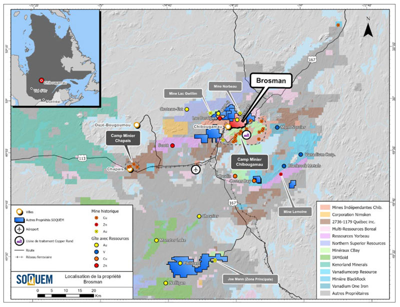
The Brosman Property is adjacent to the town of Chibougamau and extends more than 6 km eastward. In addition to containing numerous gold and polymetallic showings, the 2013 43-101 resource estimate for the property’s main deposit shows indicated resources of 97,200 t at 1.65 g/t Au, 10.5 g/t Ag and 0.35% Cu and inferred resources of 6,300 t at 0.85 g/t Au, 30.0 g/t Ag and 7,870 ppm Cu. Regionally, gold and base metal grades are associated with mineralized synvolcanic structures oriented NW-SE and/or N-S. These structures are an important metallotect for the entire Chibougamau mining camp.

The most promising area of the property lies within the Lac Line porphyry intrusion and at its contact the Roberge Sill. This area, about 1 km north of the Brosman deposit, superimposes two types of mineralization: Au-Cu±Mo porphyry and epithermal polymetallic.

Click to see the entire SOQUEM report on this property.

Location and Infrastructure

The Bruneau Property is located in the province of Quebec, Canada. Specifically, it is adjacent to Chibougamau, a town with skilled mining labour, and it extends more than 6 km to the east (Figure 1). A railway and a well-developed power grid pass close to Chibougamau and a few kilometres west of the property. The property is also about 5 km northwest of the Copper Rand mine site, which includes a copper-gold ore processing mill and tailings pond. The property is accessible year-round via a network of forestry roads. A regional airport between Chapais and Chibougamau is also part of the infrastructure. The nearest municipalities are the towns of
Chibougamau and Chapais and the two Cree communities of Mistissini and Oujé-Bougoumou.

Summary

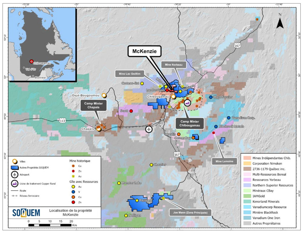
The McKenzie property is located less than 3 km from the city Chibougamau and less than 9 km from its mining camp produces nearly 1 Mt Cu and 3.2 M oz Au. This city gives access to to several infrastructures facilitating the construction of mines such as the railway, roads and an airport. The mining camp owes its history to a geological context favorable. Mafic to felsic volcanic stratigraphy represents a geological environment that is advantageous for the Establishment of synvolcanic mineralization such as volcanogenic massive sulphides and epithermal deposits such as the one in Berrigan located 1 km to the west. The presence of several intrusive systems (mafic complex, bed, sills, mafic to ultramafic, felsic plutons) testifies of a very active geodynamic environment, in particular with the Chibougamau Pluton and its satellites, which are considered to be as the driving force behind the establishment of type deposits porphyry and vein of the mining camp. One of these intrusions is the Line Lake Stock, adjacent to the property.

A few epithermal and gold vein showings have been discovered on the property. To date, the various geophysics, stripping and drilling work have made it possible to highlight potential for both types of mineralization. The best drill hole intersections are 9.8% Zn over 0.6 m for the Lac Larone showing (hole 10-458-01), and 5.7 g/t Au over 1.83 m in hole BTC-83-2. In the central part of the property, a corridor with an orientation N-S, strongly mineralized pyrite with anomalous grades of or is present. The majority of drilling in this area are also oriented N-S so that the power of this structure could not be properly evaluated. The property is in the exploration drilling stage; the future work should make it possible to target structures cross-referencing the stratigraphy using the new tools available technologies.

Click to see the entire SOQUEM report on this property.

Location and Infrastructure

The property is located in Canada, in the Province of Quebec, more precisely 2.5 km north of the city of Chibougamau (Figure 1). The latter is connected to the Saguenay-Lac-Saint-Jean and Abitibi via National Highways 167 and 113 respectively. The property is easily accessible via a network of forest roads and trails. The Canadian National Railway from Chibougamau to the Saguenay-Lac Saint-Jean is located about 1.5 km from the south of the property. The Chibougamau Regional Airport-Chapais, located 20 km southwest, offers regular flights to Montreal, and to the Cree communities. The electricity network is easy to access since there is a power line 1.6 km to the west that supplied the old Troilus mine and a transformer station 7 km to the south.

The property is also located approximately 9 km from the site of the former Copper Rand mine, which infrastructure is still in place, including the ore processing plant and the tailings pond. The engineered landfill site (LET) is located in the northern part of the property. The municipalities of Chibougamau and Chapais and the Cree communities of Mistissini and Oujé-Bougoumou are the closest and provide access to a skilled workforce and specialized businesses, as well as several businesses and services related to industrial activities. The mining industry is generally well received because of its history.

Summary

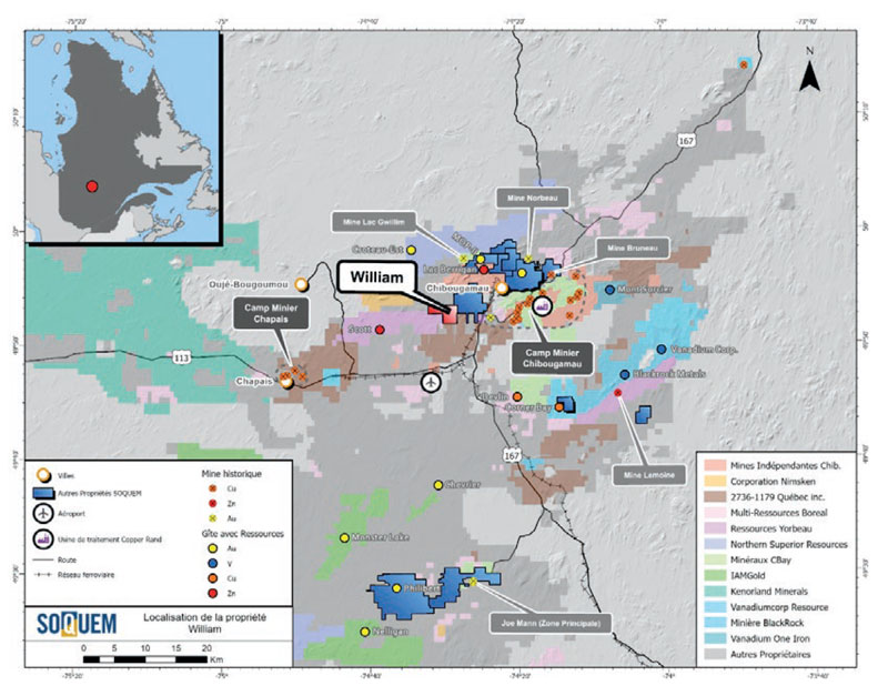
The William Property is situated 7 km southwest of the town of Chibougamau. It contains two zinc-copper-silver showings that were discovered through drilling and mapping work. The mineralization is likely of volcanogenic origin and is found in felsic volcanic rocks that are known to host the Scott Lake deposit and the former Lemoine mine.

The Millkirk showing area represents the most prospective area on the property. It contains felsic volcanic rocks overprinted by extensive hydrothermal alteration. Several occurrences of fracture-hosted zinc and copper mineralization have been observed. From a more regional perspective, the Millkirk showing and the massive sulphide lenses of the Scott Lake deposit are hosted in the same volcanic sequence – the Scott member.

The project is at the stage of exploratory drilling. A proposed
work program is available.

Click to see the entire SOQUEM report on this property.

Location and Infrastructure

The property is in the Province of Quebec, Canada, 7 km southwest of the town of Chibougamau (Figure 1). The municipality has a railway, a well-developed electrical grid and skilled workers in the mining sector. The property is also located approximately 15 km from the Copper Rand mine site, which has a copper-gold ore processing mill and a tailings pond. A motorable road and numerous forest roads on the property provide easy year-round access. The nearest municipalities are the towns of Chibougamau and Chapais and the two Cree
communities of Mistissini and Oujé-Bougoumou.

Summary

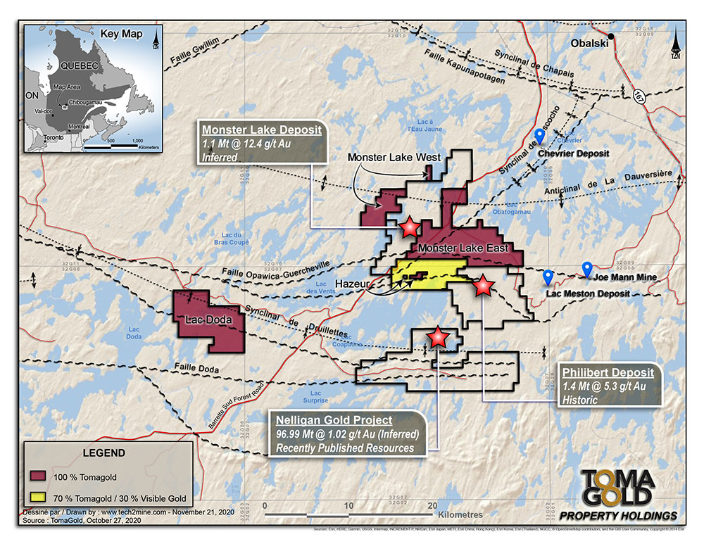
TomaGold owns a 35% interest in the Monster Lac Doda (Goliath Resources Limited: 65%), which consists of 80 mineral claims covering an area of 4,478 hectares. The property is located approximately 20 km southwest of the Monster Lake property. On July 9, 2020, the Corporation announced the signing of an option agreement for the sale of up to an 80% interest in the Lac Doda Property to Goliath Resources Limited (TSXV: GOT).

James Bay (Quebec)

Summary

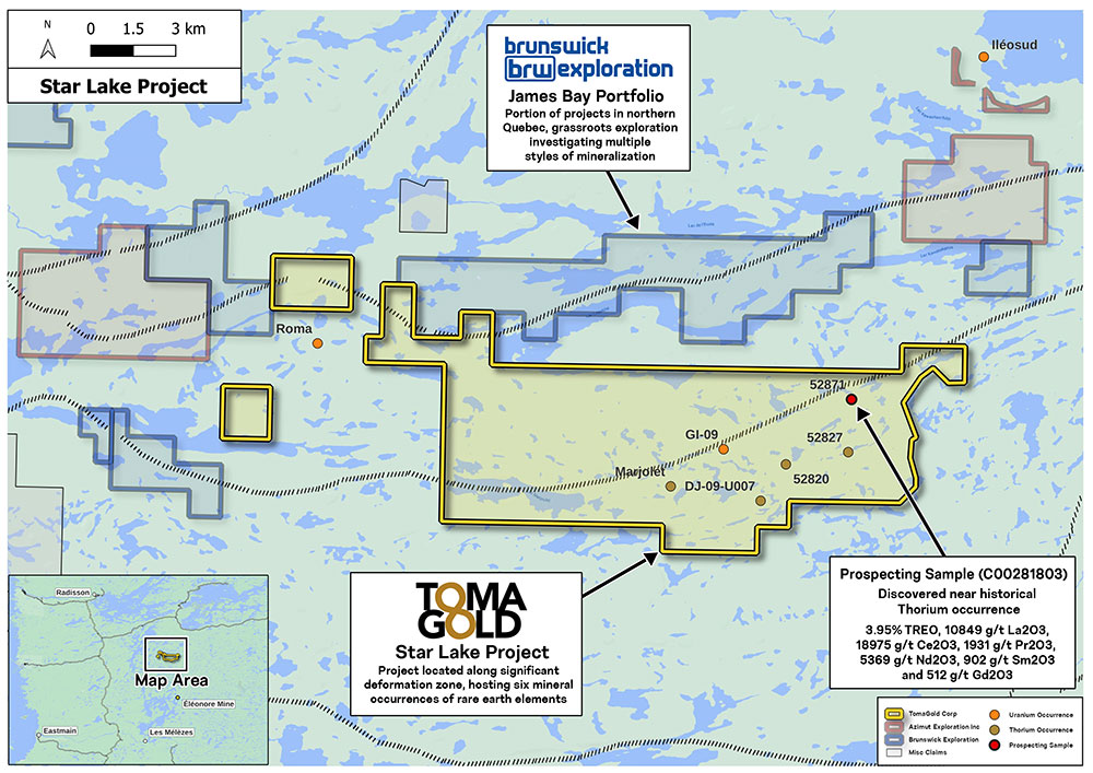
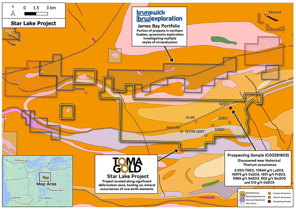
TomaGold holds a 100% interest in 214 claims over an area of 10,906 ha (or 109 km2), the largest land position in the sector. The property has been the subject of geophysical surveys that have identified six rare earth element showings.

It is characterized by multiple under-explored outcropping pegmatite intrusions that host unusual enrichment of rare earth elements, and is located in one of the world’s most mining-friendly jurisdictions, with ample green energy sources.

Red Lake (Ontario)

Summary

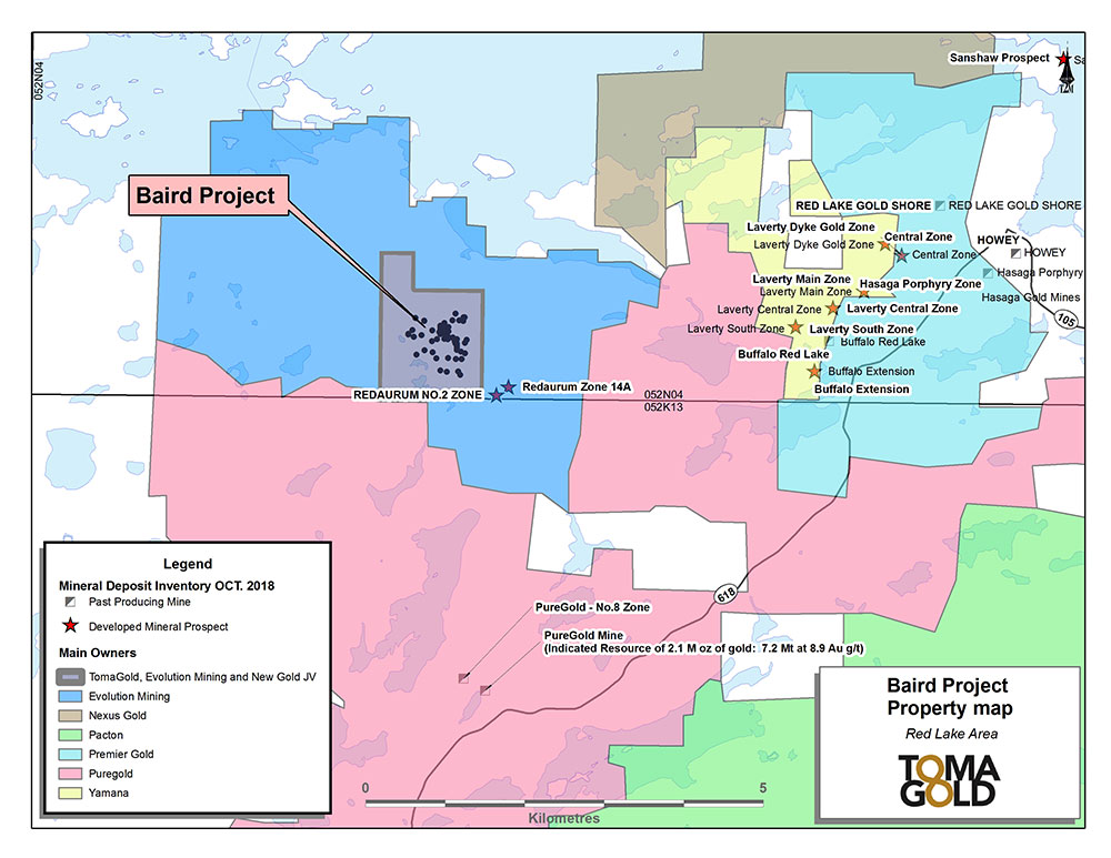
TomaGold holds a 24.5% interest in the Baird property, with Evolution Mining holding a 51% interest and New Gold Inc. the remaining 24.5% interest. The property consists of 2 claims and one mining concession covering a total of 90 hectares.

The Baird property lies in the central Red Lake gold belt six kilometres north of the Madsen Mine and fourteen kilometres southwest of the Goldcorp Red Lake Mine. The property lies within the highly prospective Balmer assemblage of volcanic rocks and exhibits structural and alteration systems typical of the Goldcorp Red Lake and Campbell mines.